Tamarit Castle<p style="text-align: justify;"><strong>The castle and the area enclosed by the walls, known as 'the vil·la closa' of Tamarit</strong> stand on a coastal promontory at the mouth of the Gaià, in an area that between the 10th and 12th centuries marked the border between the Catalan counties and the territories of <em>al-Andalus.</em> Tamarit consolidated itself as a strategic point of control of the coast, with an active port and agricultural lands. During the Middle Ages, walls, a watchtower and the Romanesque church of Santa Maria were built. The port played an important role in trade and fishing, and the town remained active until the beginning of the Modern Age, despite wars and corsair attacks.</p> <p style="text-align: justify;">From the 16th century onwards, the port fell into decline and the population emigrated, aggravated by the destruction of the castle during The Reapers' War and the depopulation of the 18th and 19th centuries. The complex was reborn at the beginning of the 20th century thanks to the collector Charles Deering, who promoted the restoration of the defensive elements, the church and the gardens. Today, Tamarit is a unique heritage complex, declared a BCIN and integrated into the Area of Natural Interest, with the area enclosed by the walls, known as 'the vil·la closa', the watchtower, the Romanesque church and remains of medieval houses, mainly used for cultural activities and events.</p>https://rutes-content.tarragona.cat/en/castell-de-tamarithttps://rutes-content.tarragona.cat/@@site-logo/logo_aj_tgna.png
Tamarit Castle
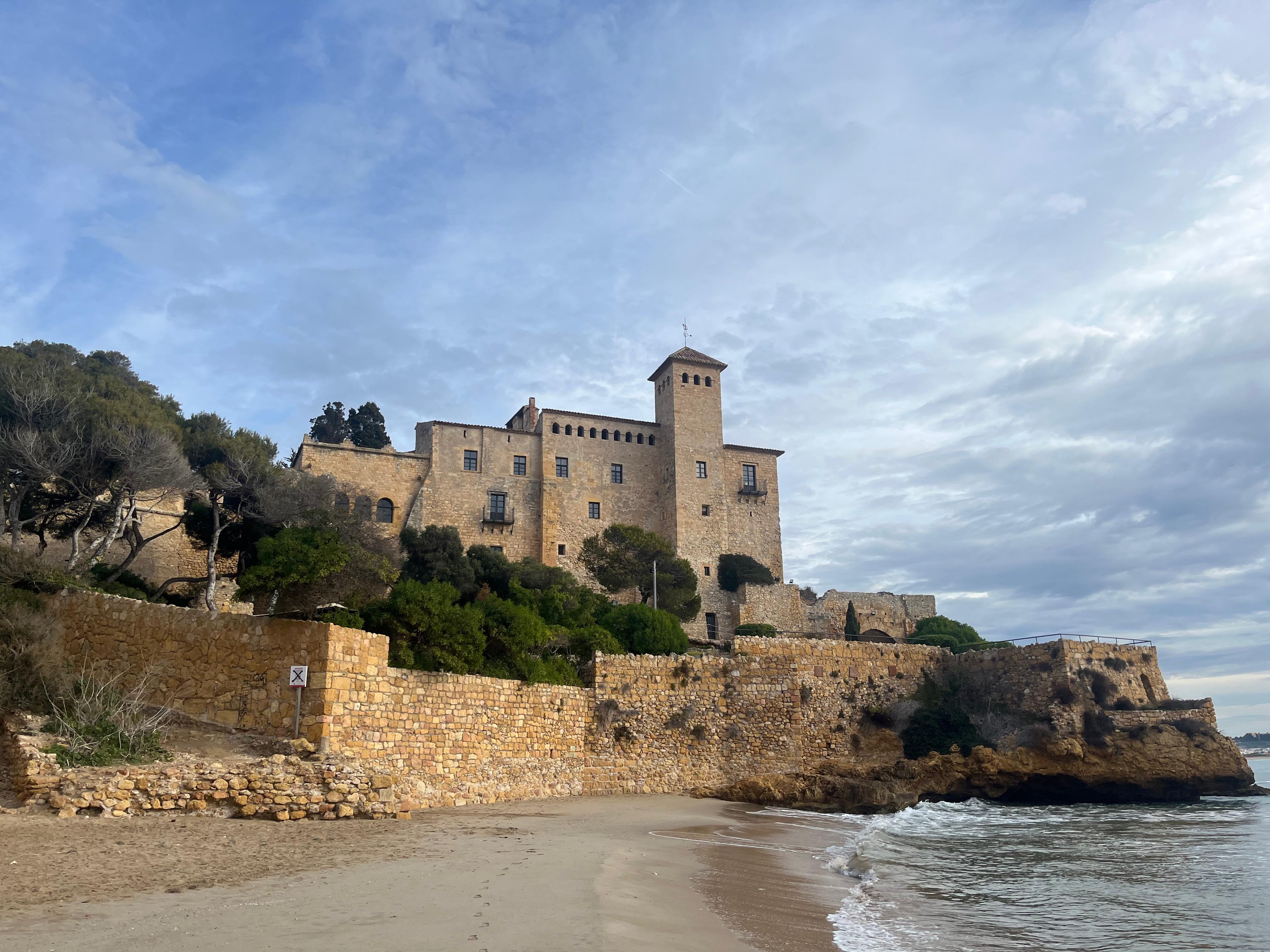
<p style="text-align: justify;"><strong>The castle and the area enclosed by the walls, known as 'the vil·la closa' of Tamarit</strong> stand on a coastal promontory at the mouth of the Gaià, in an area that between the 10th and 12th centuries marked the border between the Catalan counties and the territories of <em>al-Andalus.</em> Tamarit consolidated itself as a strategic point of control of the coast, with an active port and agricultural lands. During the Middle Ages, walls, a watchtower and the Romanesque church of Santa Maria were built. The port played an important role in trade and fishing, and the town remained active until the beginning of the Modern Age, despite wars and corsair attacks.</p> <p style="text-align: justify;">From the 16th century onwards, the port fell into decline and the population emigrated, aggravated by the destruction of the castle during The Reapers' War and the depopulation of the 18th and 19th centuries. The complex was reborn at the beginning of the 20th century thanks to the collector Charles Deering, who promoted the restoration of the defensive elements, the church and the gardens. Today, Tamarit is a unique heritage complex, declared a BCIN and integrated into the Area of Natural Interest, with the area enclosed by the walls, known as 'the vil·la closa', the watchtower, the Romanesque church and remains of medieval houses, mainly used for cultural activities and events.</p>